Quick Info
Satellite
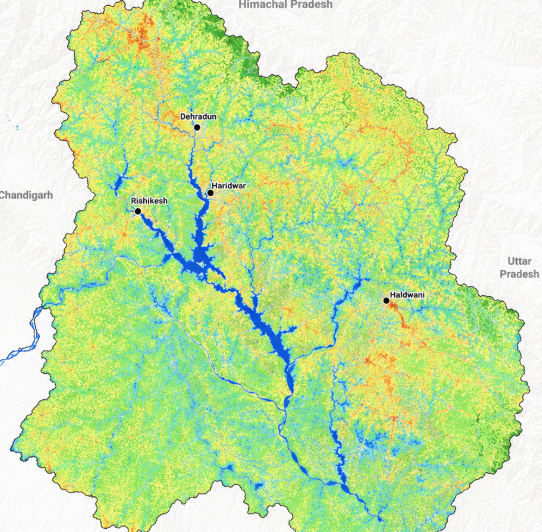
Sentinel-2
Category
Water
Min Value
-1.0
Max Value
1.0
Colormap
Blues
Bands Used
green
nir
Satellite Details
Description
NDWI highlights open water bodies by exploiting the high reflectance of water in green and low reflectance in NIR. Positive values indicate water surfaces. Widely used for mapping lakes, rivers, reservoirs, and flood extent monitoring in disaster response applications.