Quick Info
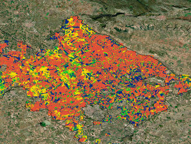
Satellite
Sentinel-2
Category
Soil
Min Value
-1.0
Max Value
1.0
Colormap
YlOrBr
Bands Used
swir16
red
nir
blue
Satellite Details
Description
BSI identifies bare soil and sparsely vegetated areas by combining SWIR, red, NIR, and blue bands. Higher values indicate exposed soil surfaces. Used in land degradation monitoring, soil erosion assessment, agricultural field mapping, and detecting areas affected by drought or overgrazing.